UN
10 Bury Road
£ 130,000
Description
We don't have a Description for this property.
- Bedrooms
- 3
- Bathrooms
- 0

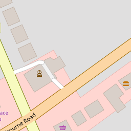
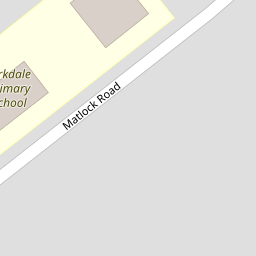

Leaflet © OpenStreetMap contributors
The heatmap indicates the level of crime in the area. The color of the heatmap indicates the crime severity and recency.
Metrics Year-on-Year
- Average area value
- 307,499.00 £Increased by 5.42 %
- Average area rental value
- 999.00 £/moIncreased by 5.94 %
- Est rental Yield
- 3.90 %Increased by 0.52 %
- Crime Rate
- 5.00 %Unchanged by 0.00 %
from 291,693.00 £
from 943.00 £/mo
from 3.88 %
from 5.00 %
Nearby Schools
| Name | Type | Ofsted | Distance |
|---|---|---|---|
| Birkdale Primary School | Community School | Good | 0.21 KM |
| St Teresa'S Catholic Infant And Nursery School | Voluntary Aided School | Good | 0.37 KM |
| Christ The King Catholic High School And Sixth Form Centre | Voluntary Aided School | Requires improvement | 0.68 KM |
| Linaker Primary School | Community School | Requires improvement | 0.93 KM |
| Linaker Children'S Centre | Children's Centre | 1.07 KM |
Images
Nearby Streets
| Name | Average Price | Average Sqft | Distance |
|---|---|---|---|
| College Close | £ 0 | 0 | 0.00 KM |
| Birch Street | £ 142,500 | 0 | 0.00 KM |
| The Walk | £ 0 | 0 | 0.00 KM |
| The Walk | £ 195,000 | 0 | 0.00 KM |
| Belgrave Place | £ 629,999 | 0 | 0.00 KM |
Nearby Transport
| Name | NLC | TLC | Distance |
|---|---|---|---|
| Birkdale | 2352 | BDL | 0.93 KM |
| Southport | 2262 | SOP | 1.86 KM |
| Hillside | 2231 | HIL | 2.17 KM |
| Meols Cop | 2357 | MEC | 3.87 KM |
| Ainsdale | 2350 | ANS | 5.05 KM |
Nearby Listings
| Address | Price | Type | Score | Distance |
|---|---|---|---|---|
| Bury Road, Birkdale, Southport, Merseyside, PR8 4EP | £ 195,000 | BUY | 6 / 10 | 0.05 KM |
| Bury Road, Southport, Merseyside, PR8 | £ 185,000 | BUY | Unknown | 0.08 KM |
| East Court, Eastbourne Road, Birkdale, Southport, PR8 | £ 100,000 | BUY | Unknown | 0.12 KM |
| Stamford Road, Birkdale, Southport, Merseyside, PR8 4ER | £ 170,000 | BUY | Unknown | 0.19 KM |
| Stamford Road, Birkdale, Southport | £ 160,000 | BUY | 7 / 10 | 0.21 KM |
Nearby Properties
| Address | Price | Distance |
|---|---|---|
| 10 Bury Road | £ 130,000 | 0.00 KM |
| 36 Bury Road | £ 144,500 | 0.00 KM |
| 23b Bury Road | £ 112,000 | 0.00 KM |
| 25 Bury Road | £ 25,001 | 0.00 KM |
| 20 Bury Road | £ 152,000 | 0.00 KM |